Wealthy U.S. Coastal Cities Sinking Rapidly, Risk Submersion Within 25 Years, Scientists Warn
California’s Wealthiest Coastal Cities Face Submersion Threat by 2050
California’s affluent coastal cities, including Los Angeles, San Francisco, San Diego, and Alameda, could be inundated by rising sea levels and sinking land within decades, according to a Virginia Institute of Marine Science (VIMS) report. The study warns that higher tides, erosion, and subsidence—combined with accelerating sea level rise—could displace communities, shrink beaches, and inflict billions in damage by 2050.
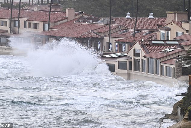
San Diego is particularly vulnerable, with sea levels rising 2.6 millimeters annually—the fastest rate on the West Coast. By midcentury, the city and neighboring regions could see water levels several inches above global averages, increasing flood risks for coastal infrastructure and residents. Over 26 million Californians live near the coast, where projected damages could reach $18 billion. San Francisco alone may need $110 billion for flood defenses.
[Image 1: San Diego’s shoreline with a caption: San Diego faces the highest sea level rise on the West Coast, threatening beaches and coastal neighborhoods.]
East and Gulf Coast Cities at Greater Risk
While California grapples with steady sea level rise, the East Coast faces faster acceleration. New York, Boston, Baltimore, and southern cities like Charleston and Savannah could see waters rise over a foot by 2050. NASA researchers attribute this to melting ice sheets in Greenland, altering ocean currents and amplifying regional threats.
Gulf Coast cities, however, are sinking even more rapidly. Rockport, Texas, may face a 2.5-foot sea level increase by 2050. Louisiana and Florida are also at risk, with sinking land compounding the crisis. New Orleans, already sinking up to two inches yearly due to soft soil, remains a hotspot for flooding. A 2024 study warned that sinking coastal zones could displace 500,000 residents nationwide, with damages exceeding $109 billion.
[Image 2: NASA land subsidence map with caption: NASA’s map highlights sinking land (blue) and rising areas (red) along California’s coast and Central Valley.]
Tracking the Crisis
VIMS researchers used 55 years of tidal gauge data, tracking monthly averages and storm-driven extremes. They factored in land subsidence, ocean currents, and climate patterns like El Niño to project localized risks. Findings revealed “accelerating” sea level rise in Gulf states like Texas and Louisiana, while East Coast cities are catching up quickly.
Molly Mitchell, a VIMS marine scientist, emphasizes the urgency: “Residents need actionable plans for the next few decades.” Mitigation efforts, from seawalls to managed retreats, are critical to safeguarding economies and lives.
[Image 3: Flooded neighborhood with caption: Projections suggest over 500,000 Americans in 32 cities could face displacement by 2050 due to coastal flooding.]
As the clock ticks, communities must balance costly infrastructure projects with the stark reality of a changing coastline—one that may reshape America’s map within a generation.


