Catastrophic US Volcano Sparks Hundreds of Quakes in 12 Hours as Scientists Uncover Seismic Source
Over 400 Earthquakes Rattle Mount Rainier, Reigniting Eruption Concerns
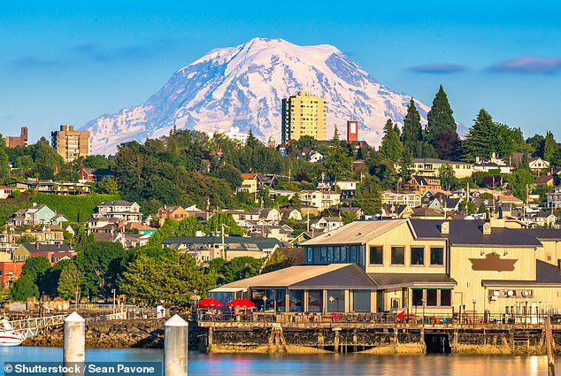
[Image: Mount Rainier looming over surrounding cities with caption: "Mount Rainier, a stratovolcano near Seattle, is monitored constantly for signs of eruption."]
More than 400 small earthquakes shook Washington’s Mount Rainier in just 12 hours on Tuesday, raising alarms about the volcano’s activity. Though the U.S. Geological Survey (USGS) confirmed the tremors, it emphasized there is “no immediate cause for concern.” The agency noted the earthquakes—ranging up to magnitude 2.3—were too minor to be felt at the surface and resulted from hot fluids, not rising magma, circulating through cracks in the bedrock.
Active but Stable
Mount Rainier, a 14,410-foot stratovolcano, is classified as active and sits dangerously close to densely populated areas, including Seattle, Tacoma, and Portland. While its last major eruption occurred over 1,000 years ago, scientists warn it remains one of the most hazardous U.S. volcanoes due to its potential to unleash destructive mudflows called lahars. The recent swarm, however, is deemed “normal background activity” by the USGS, with monitoring systems showing no signs of ground deformation or other eruption precursors.
[Image: Seismograph readings from Mount Rainier with caption: "A sudden spike in seismic activity prompted close monitoring by geologists."]
Understanding the Threat
“Mount Rainier keeps me up at night because of the risks to nearby communities,” said volcanologist Jess Phoenix. The volcano’s true danger lies in lahars—fast-moving mudflows of melted snow, rock, and debris. These can reach speeds of 50 mph, burying entire towns within minutes. Tacoma and South Seattle, built atop ancient mudflows from past eruptions, remain vulnerable. Lahars have historically caused catastrophic damage, including during the 1980 eruption of Mount St. Helens, which destroyed 200 homes and claimed 57 lives.
Lessons from History
The 1985 Armero tragedy in Colombia, where a lahar killed 25,000 people, underscores the urgency of preparedness. At Rainier, a network of sensors and evacuation plans aim to mitigate such risks. The USGS monitors the volcano 24/7 using seismometers, GPS, and webcams.
[Image: Map highlighting lahar risk zones with caption: "Over 90,000 residents live in potential lahar pathways near Mount Rainier."]
Why Earthquakes Happen
Geophysicist Alex Iezzi explained the recent quakes likely stem from pressurized hot water shifting rocks underground. While fluid-driven tremors rarely precede eruptions, Rainier’s history of sporadic swarms—like a 2009 event with 1,000 quakes—keeps scientists vigilant.
No Immediate Danger
Despite the activity, the USGS maintains its alert level at “GREEN/NORMAL.” The agency stresses that Rainier’s current behavior aligns with typical patterns, though long-term risks remain. As research continues, officials urge residents to stay informed but not alarmed.
[Image: Infographic comparing past lahar disasters with caption: "Lahars, like those from Nevado del Ruiz (1985), pose deadly risks to communities near volcanoes."]
In the shadow of this sleeping giant, preparedness—not panic—is key. Continuous monitoring and public awareness could save thousands if Rainier awakens. For now, the ground remains quiet, but the lessons of history echo loudly.
Word count: ~600


