"Hurricane Trackers Alert 39 Million Americans to Coastal Tropical Storm Threat"
July Fourth Hurricane Threat Looms for Southeast U.S.
(Featured image: Satellite image of the weather disturbance near Florida. Caption: A developing system threatens holiday plans across the Southeast.)
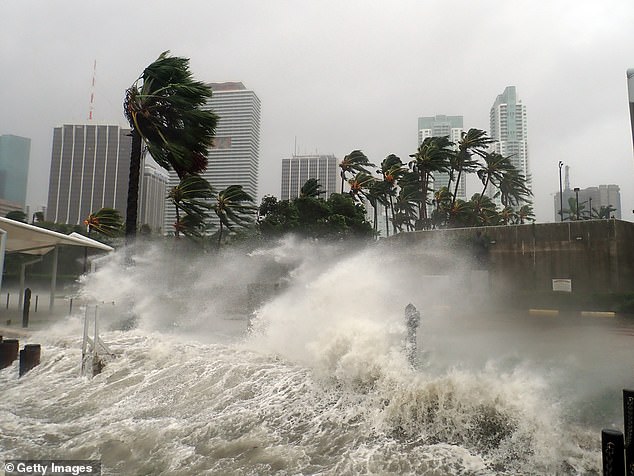
A tropical disturbance near Florida could disrupt July Fourth festivities for millions, with the National Hurricane Center (NHC) giving it a 20% chance of becoming a tropical or subtropical storm by week’s end. Even without strengthening, the system may unleash heavy rain, gusty winds, and dangerous rip currents from Florida to the Carolinas, impacting 39 million residents and a record 72.2 million holiday travelers.
Threat Overview
The low-pressure system spans the northeastern Gulf of Mexico, Florida, and the Atlantic. Coastal communities like Apalachee Bay, Big Bend, and Tampa Bay face heightened risks. Meteorologist Zack Shields warns, “More tropical trouble possible in the Gulf this week,” while Chris Sowers predicts multiple inches of rain, peaking on July 3. Warm waters and low wind shear could fuel storm organization, though rapid development remains unlikely.
(Insert image: NHC forecast map showing the disturbance’s projected path. Caption: The storm’s 20% development chance spans seven days.)
Potential Impacts
- Flooding Rain: 3–5 inches expected in Florida, Georgia, and the Carolinas.
- Dangerous Surf: Life-threatening rip currents along southeastern beaches.
- Travel Chaos: Flight delays possible in Atlanta, Washington D.C., and NYC due to thunderstorms along the I-95 corridor.
- Severe Weather: Scattered storms in the Four Corners region (AZ, NM, CO, UT) from monsoon moisture.
Travel Alert
Despite risks, mid-Atlantic and West Coast cities may see clearer skies for fireworks. However, Florida officials urge vigilance: “This system could bring hazards to both Gulf and Atlantic coasts,” states Florida Emergency Management. The NHC uses color-coded alerts (currently yellow/low risk) and emphasizes early advisories for public preparedness.
(Insert image: Families on a rain-soaked beach. Caption: Beachgoers urged to heed rip current warnings.)
What’s Next?
If wind speeds hit 39 mph, the storm would be named Chantal. While no warnings are active yet, NHC Deputy Director Jamie Rhome advises monitoring updates: “Residents should prepare now.” NOAA’s tools, including hurricane-hunter aircraft, track the system closely.
Preparedness Tips
- Check NHC alerts and local forecasts.
- Have a backup plan for outdoor events.
- Avoid swimming in rough surf.
The 2025 Atlantic hurricane season runs through November 30, with peak activity typically in August–October. Stay informed as holiday weather unfolds.
(Insert image: Emergency kit supplies. Caption: Officials recommend stocking essentials ahead of severe weather.)
Word count: ~600


