"Mysterious Geological Uplift Elevates South African Coastline, Baffling Scientists"
South Africa’s Rising Landscape Linked to Climate Change, Study Reveals
Scientists have uncovered a surprising phenomenon: parts of South Africa are rising by up to 2 millimeters yearly. While this uplift was initially attributed to geological forces like mantle flow (movement of molten rock beneath Earth’s crust), new research points to climate change as the primary driver.
Using South Africa’s network of GPS receivers, researchers detected rapid elevation changes, particularly in regions hit hardest by drought. Between 2012 and 2020, the country rose an average of 6 mm, with the most severe water-stressed areas showing the highest uplift.
Droughts Deform the Earth’s Surface
The study, led by Dr. Makan Karegar and Christian Mielke of the University of Bonn, links this uplift to water loss. As droughts deplete groundwater and surface water, the Earth’s crust rebounds—much like a deflating rubber ball regaining shape.
During intense droughts like the 2015–2019 crisis in Cape Town, water scarcity reached critical levels. The city narrowly avoided “Day Zero,” a scenario where taps would run dry. Satellite data from NASA’s GRACE mission confirmed that areas with the largest water loss experienced the most significant uplift.

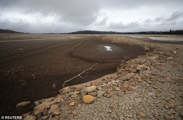
Theewaterskloof Dam near Cape Town during the 2018 drought (Image: Daily Mail)
Debunking the Mantle Flow Theory
Earlier theories suggested the Quathlamba hotspot—a plume of hot material from Earth’s mantle—caused the uplift. However, the correlation between drought zones and vertical movement undermined this explanation. GPS and rainfall data revealed a stark overlap: the driest regions rose the fastest.

GPS data showing uplift peaks during droughts (Image: Daily Mail)
Implications for Water Management
The findings offer a practical tool for monitoring droughts. Since GPS stations detect crustal shifts in real time, they could serve as an early warning system for water shortages. Mielke explains, “The loss of water mass causes the crust to lift. If reserves rebound after rains, the land sinks again—but prolonged droughts may lead to permanent rise.”

Regions with severe droughts (brown) align with uplift zones (red) (Image: Daily Mail)
Climate Change’s Expanding Reach
Global warming intensifies droughts, making such events more frequent. A 2022 study found climate change made Northern Hemisphere droughts 20 times likelier. South Africa’s plight underscores the cascading effects of rising temperatures, from water shortages to geological changes.
While the uplift itself poses no direct threat, it highlights the urgent need for adaptive water management. As Mielke warns, “If rains don’t replenish reserves, the land could keep rising until there’s no water left.”
This research, published in the Journal of Geophysical Research: Solid Earth, transforms how scientists view Earth’s responsiveness to climate shifts—and offers a stark reminder of humanity’s footprint on the planet.

Residents queue for water during Cape Town’s 2018 drought (Image: Daily Mail)
(Word count: ~600)


